SenseFly Intros eBee Ag
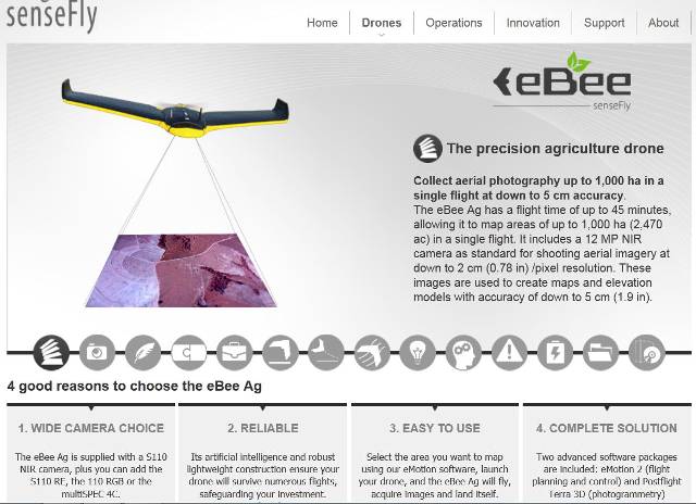
Referred to on its website as “the precision agriculture drone,” the company says users will be able to collect aerial photography of up to 1,000 hectare in a single flight, with an image resolution down to five centimeters in accuracy, right out of the box.
The eBee Ag website lists a flight time of up to 45 minutes, and includes details on the 12 mega pixel near-infrared spectroscopy (NIR) camera that comes as standard equipment.
Besides the stock S110 NIR camera, SenseFly offers several upgrade options, one of which is its much-anticipated MultiSPEC 4C, a cutting-edge sensor unit developed by French outfit Airinov’s agronomy specialists and customized for the eBee Ag. It contains four separate 1.2 megapixel sensors that are electronically integrated within the eBee’s autopilot, providing image data over four highly precise bands (Green, Red, Red Edge and NIR), as well as “sharp, undistorted images and unparalleled data accuracy,” according to SenseFly.
eBee Ag also includes two software suites: eMotion2 for flight control and Postflight Terra 3D for post-flight image processing.
According to SenseFly the system’s capabilities include the following:
- Plant stress assessment.
- Yield monitoring.
- Chlorophyll indication.
- Senescence analysis.
- Drought assessment.
- Biomass indication.
- Leaf area indexing.
- Nitrogen recommendation.
- Phenology.
- Growth monitoring.
- Crop discrimination.
- Leaf area indexing.
- Tree classification.
- Plant counting.
For more information on the eBee Ag, visit SenseFly’s website here.